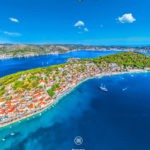
Rogoznica is a wonderful place for vacation
Rogoznica is located 34 km away from Šibenik, in the southern part of Šibenik-Knin County, protected from wind in a deep bay. It penetrates deep into the Adriatic Sea as the most protruding part of the Croatian mainland, in a geographical position that places it in the center of the Dalmatian coast. Rogoznica has a coastline of 54 km. The location of Rogoznica itself forms the border of the North and South Adriatic, the first thing that is noticed by special climatological movements in the area, with the collision of climate (electricity, wind, south and bora) on Rogoznica Cape Planka.
Tourist characteristics are an important factor in the climate in the Rogoznica area with an average of 2600 hours of sunshine. From the history of Rogoznica, it is good to emphasize the movements of the population encouraged by the threat of the Turks, in 1518, where the population moved to the island. Historical records date back to 1390, when the mainland of Rogoznica was completely inhabited.
Connected into one whole by an artificial embankment, the center of Rogoznica is today a mainland part called Kopača and the islet of Kopara. Authentic Mediterranean atmosphere on the Rogoznica waterfront is given by old stone houses in the center of Rogoznica where the peninsula is located.
All boaters can rely on a safe anchorage with deep draft, because the beautiful fishing village with its harbor is naturally protected. Apart from boaters, this beautiful place with Dragon Lake in the karst rock with islets and bays, beautiful beaches, a long promenade by the sea and dense pine forests, attracts many tourists.
History
The nearby island of Kopara was inhabited in 1518 due to the danger from the Turks, the first settlers of the mainland of today's Rogoznica Kopača inhabited in 1390. After the danger from the Turks ceased, the island was connected to the mainland by a bridge. The island also received a building in 1809, during the French rule in the form of a fortress. There is evidence that these areas were visited by settlers before 1390, in support of which is the old church of St. Ivan of Trogir from 1324, on the nearby cape Ploče and the chapel of St. Nikola inside the Loznica cave.
The main occupation of today's population of Rogoznica is tourism, fishing and land cultivation.
PLACES OF INTEREST
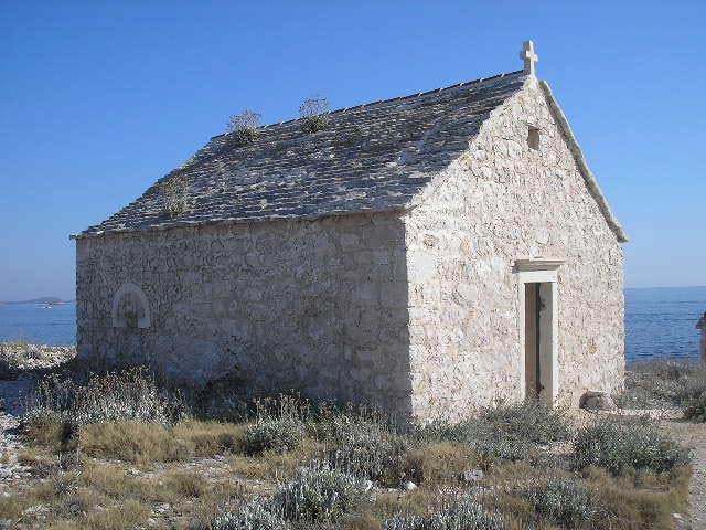
Church of St. Ivan of Trogir on Cape Planka
In the deserted and rocky area is the church of Sv. Ivana on Cape Planka. It was built for the purpose of vows, on the place where, according to legend, Bishop Ivan (Bishop of Trogir from 1062) miraculously saved shipwrecked people by walking on the sea. Called the Dalmatian Haridba, Cape Planka is the most dangerous navigation point on the eastern Adriatic coast. The prominent part of the mainland from Šibenik to Trogir is called the Hilej Peninsula, and the cape was called promunturium Diomedis in ancient times.
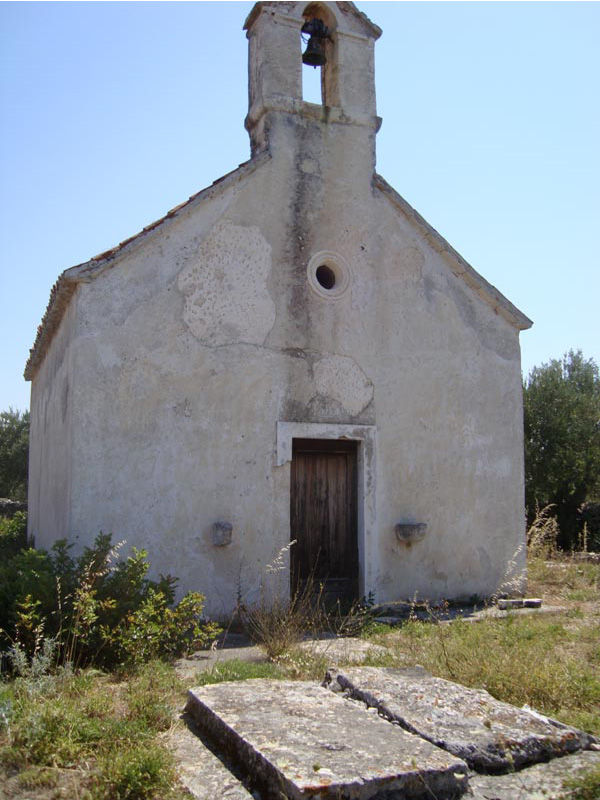
Church of St. Nicholas
In the bay of Lozica northwest of the Rogoznica peninsula is the Church of St. Nicholas, in a part called the Old Village or Vecchia Rogoznica. This highly protected monument of sacral heritage dates back to the early 14th century although archaeologists and historians believe it is older. Around the church is an old Croatian cemetery from the 13th century with unusual tombstones.
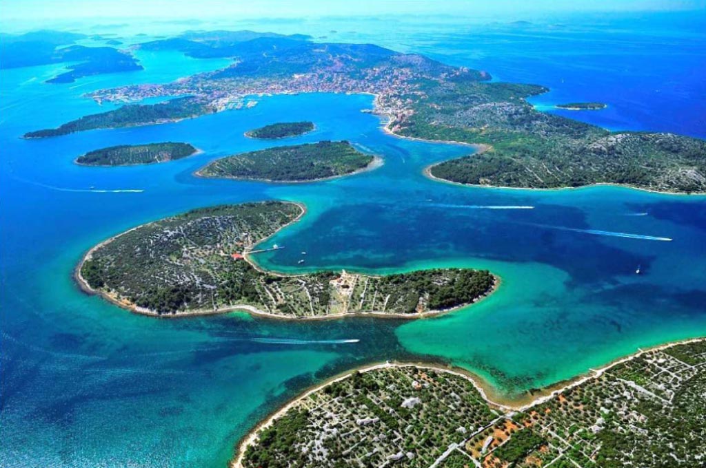
Kornati National Park
Kornati National Park is located 20 nautical miles from Rogoznica. 89 uninhabited islands, islets and cliffs that are located on only 70 square kilometers. From Rogoznica to the Kornati National Park you can come by your own or rented boat, and during the summer season by an organized full day trip on one of the excursion boats from Rogoznica.
Krka National Park
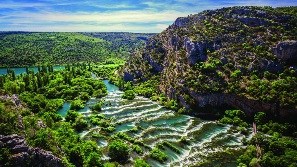
At a total height of 242 meters and Skradinski buk, the largest travertine barrier in Europe and its seven waterfalls, the Krka National Park is a natural and karst phenomenon. Krka National Park is located at a distance of 40 kilometers from Rogoznica. From Rogoznica to the Krka National Park you can go by car or go on a very attractive, organized excursion boat trip that is available from Rogoznica during the summer season.
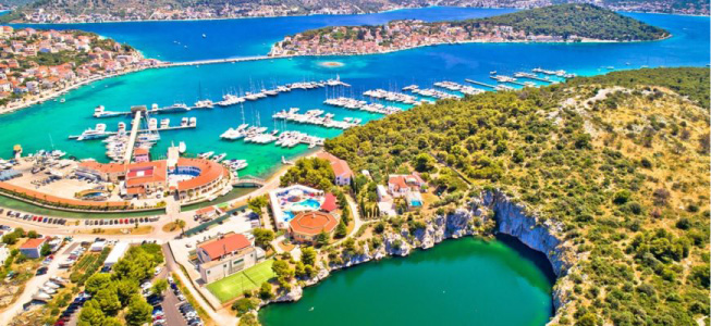
Dragon's Eye Lake
Hydrogeomorphological phenomenon of the eastern Adriatic coast called Dragon's Eye, developed a distinctive flora and fauna with special physico-chemical properties. The lake is located along a thin isthmus that separates the bays of Soline and Koprišće on the Gradina peninsula. It is adorned in a circle of vertical rocks 4 to 24 meters high. The surface of the lake itself is about 10,000 m², and the maximum measured depth is 15 meters. Although the lake has no connection with the sea there is an exchange of lake and sea water through cracks and channels in the porous limestone. The unique and special environment of the Dragon's Eye, with a thick lower layer of hydrogen sulfide, has attracted the interest of many domestic and foreign scientists in recent years.